
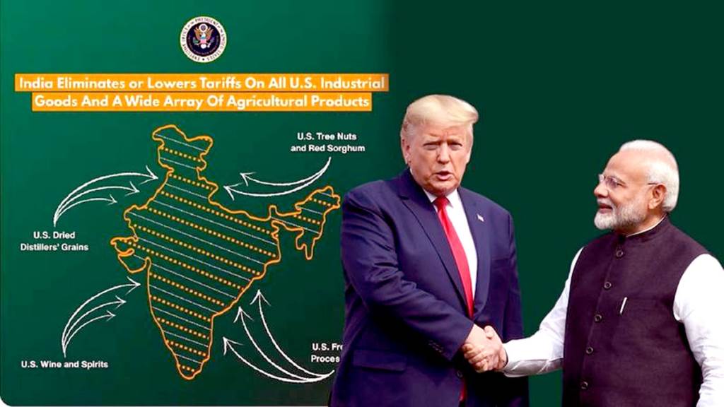
Chandigarh, February 7:- As India and the US announced the framework for an interim trade deal on Saturday, a map released by the Office of the US Trade Representative caught the attention of the online world. The map shows the entire Jammu and Kashmir region—including Pakistan-occupied Kashmir—as part of India, along with Aksai Chin, which China claims.
While India has always maintained that Jammu and Kashmir is an integral part of the country, this depiction is different from previous US maps, which generally showed PoK as a disputed territory. The latest map is being seen as a subtle but significant shift in Washington’s stance.
The timing of the move is significant as India and the US are trying to rebuild ties after a period of strain. Earlier, the Trump administration had imposed a 50 per cent tariff on Indian goods — the highest among US allies. Under the interim trade framework, it has now been reduced to 18 per cent, the lowest for any Asian country.
The release of the map comes amid President Donald Trump’s attempts to re-align India and Pakistan, which is at odds with the long-standing US policy of treating the two countries separately.
The inclusion of Aksai Chin as part of India is equally significant. China has consistently asserted its claim over the region despite India’s objections. New Delhi has often expressed concern over the misrepresentation of its borders, particularly Jammu and Kashmir and Arunachal Pradesh, by foreign governments and global agencies. Experts and commentators have welcomed the US move.
Retired Major Gaurav Arya hailed the portrayal as a clear signal of support for India's regional position, India Today reported. Many analysts have called it a setback to Pakistan's recent diplomatic outreach to Washington. In the last six months, Pakistan's Army Chief General Asim Munir has visited the US three times and met President Trump twice, including a much-discussed lunch in June.