
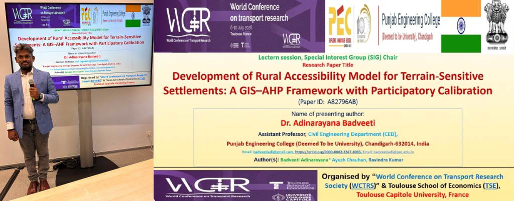
Chandigarh, July 14, 2026:- Punjab Engineering College (Deemed to be University), Chandigarh, brought international recognition to India by presenting its research at the prestigious World Conference on Transport Research (WCTR 2026) held in Toulouse, France, from July 6 to 10, 2026. The conference was organized by the World Conference on Transport Research Society (WCTRS) in collaboration with the Toulouse School of Economics (TSE) and Toulouse Capitole University, France.
Dr. B. Adinarayana, Assistant Professor in the Department of Civil Engineering at Punjab Engineering College, presented his research paper titled "Development of Rural Accessibility Model for Terrain-Sensitive Settlements: A GIS–AHP Framework with Participatory Calibration" (Paper ID: A82796AB). The study focuses on developing a terrain-sensitive rural accessibility model for settlements located in mountainous regions.
The technical session witnessed participation from nearly 60 international academicians, scientists, researchers, transport experts, and delegates, who engaged in extensive technical discussions and knowledge exchange following the presentation.
The conference attracted transport researchers, policymakers, academicians, industry experts, and professionals from around 140 countries, providing a significant platform for global knowledge sharing, scientific collaboration, and networking in transport research.
The research integrates Geographic Information Systems (GIS), Analytic Hierarchy Process (AHP), Machine Learning, Remote Sensing, and stakeholder participation to develop an innovative rural accessibility model that supports equitable and sustainable infrastructure planning. The model was applied to 1,176 rural settlements in West Garo Hills district of Meghalaya, covering a population of approximately 501,000.
The research methodology incorporated terrain-based travel impedance modelling, Digital Elevation Models (DEM), road network analysis, cost-distance modelling, Sentinel-2 satellite imagery, Random Forest-based settlement classification, and stakeholder-derived AHP weighting.
Key Findings:
*Developed a novel GIS–AHP-based accessibility assessment model for mountainous rural regions.
*Achieved 89.7% classification accuracy of settlements using Machine Learning and Remote Sensing.
*The Accessibility Index ranged from 0.130 to 0.642, indicating nearly a five-fold disparity in accessibility.
*57.7% of rural settlements were classified as having low or very low accessibility.
*More than half of the district's population lacks adequate access to essential public services.
*81% of the least-accessible settlements are located at elevations above 600 metres.
*The study found that road connectivity alone does not accurately reflect accessibility, while travel-time-based accessibility assessment provides more realistic results.
*Comparative analysis using national and international benchmarks showed that West Garo Hills performs below the global average in rural accessibility.
The research makes a significant contribution to the United Nations Sustainable Development Goals (SDGs), particularly SDG 9 (Industry, Innovation and Infrastructure) and SDG 11 (Sustainable Cities and Communities).
The model offers policymakers, transport planners, government agencies, and development organizations a scientific framework for prioritizing infrastructure investments in geographically challenging regions.
Future research will enhance the model by incorporating real-time GPS data, crowdsourced mobility data, digital connectivity indicators, and seasonal accessibility analysis.
The presentation at WCTR 2026 also provided an excellent opportunity to engage with international experts and establish new global research collaborations. The study demonstrates how the integration of GIS, Machine Learning, and participatory planning can significantly improve infrastructure planning and accessibility assessment in remote and mountainous regions.